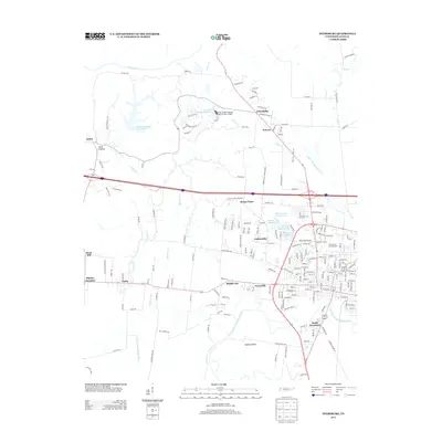
2013 Map of Dyersburg
USGS Topo · Published 2013About this map
South Dyersburg and the surrounding Dyer County landscape are defined by a complex network of waterways, centered on the North Fork Forked Deer River and its meandering Samaria Bend. This 2013 survey illustrates the modern residential and commercial expansion of the region, anchored by established communities like Finley and Middle City. The map reveals the historical topographical variety of West Tennessee, from the Chickasaw Blf to the lowlands along the Obion River. To the north, the terrain is dotted with small settlements such as Friendship, Nauvoo, and Jenkinsville, while numerous water features like Pioneer Lake Number One and various drainage ditches indicate the long-term management of this fertile alluvial plain. Notable local landmarks, including the E H Lannom Jr Gymnasium, are mapped alongside the rural road network that connects outlying areas like Peck Hollow and Big Boy Junction to the urban core.
Find a feature on this map
193 named features on this map. Tap any name to fly to it.
Don’t see what you’re looking for? This feature index may not catch every label — zoom into the map to look around manually.
Map Details
Editions of this 2013 Dyersburg Map
This is the sole edition of this map. No revisions or reprints were ever made.
Other maps of this area

1939 · Dyersburg
USGS Topo · 1:62,500

1939 · Hales Point
USGS Topo · 1:62,500

1939 · Caruthersville
USGS Topo · 1:62,500

1939 · Halls
USGS Topo · 1:62,500

1951 · Caruthersville
USGS Topo · 1:62,500

1952 · Hales Point
USGS Topo · 1:62,500

1952 · Bonicord
USGS Topo · 1:24,000

1952 · Newbern
USGS Topo · 1:24,000

1952 · Lane
USGS Topo · 1:24,000

1952 · Dyersburg
USGS Topo · 1:24,000