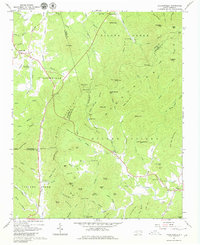
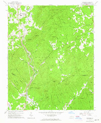
1962 Map of Dysartsville
USGS Topo · Published 1980About this map
Dysartsville and the surrounding high country of the South Mountain range anchor this 1962 field-checked record of Burke, McDowell, and Rutherford counties. The landscape is defined by the headwaters of the Broad River and First Broad River, which carve through the Golden Valley and along the base of prominent peaks like Silver Creek Knob and Propst Mtn. This era shows a transition in land use, where traditional rural life—evidenced by Logans Store and numerous country churches like Missionary Ch and Cane Creek Ch—exists alongside modern infrastructure such as Flood Control Dam No 20.
Find a feature on this map
108 named features on this map. Tap any name to fly to it.
Don’t see what you’re looking for? This feature index may not catch every label — zoom into the map to look around manually.
Map Details
Editions of this 1962 Dysartsville Map
3 editions found
Other maps of this area

1905 · Morganton
USGS Topo · 1:125,000

1950 · Shelby
USGS Topo · 1:62,500

1953 · Charlotte
USGS Topo · 1:250,000

1954 · Charlotte
USGS Topo · 1:250,000

1956 · Benn Knob
USGS Topo · 1:24,000

1956 · Morganton South
USGS Topo · 1:24,000

1960 · Charlotte
USGS Topo · 1:250,000

1962 · Charlotte
USGS Topo · 1:250,000
1962 · Glen Alpine
USGS Topo · 1:24,000
1962 · Glenwood
USGS Topo · 1:24,000