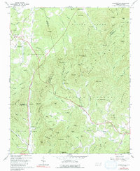
1962 Map of Dysartsville
USGS Topo · Published 1991About this map
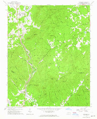
The South Mountains dominate this landscape where the borders of Burke, McDowell, and Rutherford Counties converge. This early 1960s topographic record shows a community oriented around the winding First Broad River and its numerous tributaries like Muddy Creek and Silver Creek. Settlement patterns are concentrated in small rural hubs such as Dysartsville and Brindletown, which are connected by a network of unimproved and light-duty roads. Local life is anchored by country churches including Fairview Ch, Golden Valley Ch, and Cane Creek Ch.
Find a feature on this map
96 named features on this map. Tap any name to fly to it.
Don’t see what you’re looking for? This feature index may not catch every label — zoom into the map to look around manually.
Map Details
Editions of this 1962 Dysartsville Map
3 editions found
Other maps of this area

1905 · Morganton
USGS Topo · 1:125,000

1950 · Shelby
USGS Topo · 1:62,500

1953 · Charlotte
USGS Topo · 1:250,000

1954 · Charlotte
USGS Topo · 1:250,000

1956 · Benn Knob
USGS Topo · 1:24,000

1956 · Morganton South
USGS Topo · 1:24,000

1960 · Charlotte
USGS Topo · 1:250,000

1962 · Charlotte
USGS Topo · 1:250,000
1962 · Glen Alpine
USGS Topo · 1:24,000
1962 · Glenwood
USGS Topo · 1:24,000