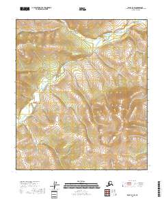
2018 Map of Eagle A-3 SW
USGS Topo · Published 2018About this map
Taylor Mtn stands as a prominent elevation in this high-altitude Alaskan landscape, situated within a topography dominated by the drainage systems of the Mosquito Fork. This 2018 survey reveals a terrain defined by its watercourses, where Gold Cr and Taylor Cr cut through the northern and southern sectors respectively. The landscape is largely unpopulated, representing a preservation of the natural hydrology and elevation patterns characteristic of the Southeast Fairbanks Census Area. The absence of roads or permanent structures reflects the wilderness nature of the region, emphasizing the importance of natural landmarks for navigation.
Find a feature on this map
9 named features on this map. Tap any name to fly to it.
Don’t see what you’re looking for? This feature index may not catch every label — zoom into the map to look around manually.
Map Details
Editions of this 2018 Eagle A-3 SW Map
This is the sole edition of this map. No revisions or reprints were ever made.
Other maps of this area

1949 · Tanacross
USGS Topo · 1:250,000

1950 · Tanacross
USGS Topo · 1:250,000

1951 · Eagle
USGS Topo · 1:250,000

1956 · Tanacross D-3
USGS Topo · 1:63,360

1956 · Tanacross D-4
USGS Topo · 1:63,360

1956 · Eagle A-4
USGS Topo · 1:63,360

1956 · Tanacross
USGS Topo · 1:250,000
1957 · Eagle A-3
USGS Topo · 1:63,360

1957 · Eagle
USGS Topo · 1:250,000

1964 · Tanacross
USGS Topo · 1:250,000