1964 Map of Tanacross
USGS Topo · Published 1965About this map
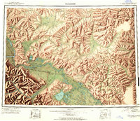
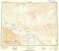
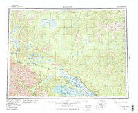
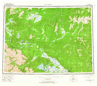
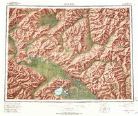
Tetlin Indian Reservation anchors the southern landscape of this 1960s survey, a region defined by the complex waterways of the Tanana River and the extensive Mosquito Flats. The era's transportation network is clearly visible, featuring the Taylor Highway and the historic Eagle Trail, alongside several winter routes that supported seasonal movement through the interior. Settlements such as Mansfield Village, Tanacross, and Last Tetlin Village are documented near the riverbanks, alongside commercial outposts like Riverside Lodge and Log Cabin Inn.
Find a feature on this map
96 named features on this map. Tap any name to fly to it.
Don’t see what you’re looking for? This feature index may not catch every label — zoom into the map to look around manually.
Map Details
Editions of this 1964 Tanacross Map
2 editions found
Historical Maps of Tok Through Time
4 maps found