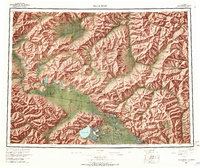
1964 Map of Tanacross
USGS Topo · Published 1966About this map
The Tanana River serves as the central artery for this mid-1960s survey of east-central Alaska, where the Alaska Highway meets the rugged foothills of the Alaska Range. This landscape is defined by the intersection of traditional native lands and modern transportation corridors, prominently featuring the Tetlin Indian Reservation and settlements such as Tanacross, Mansfield Village, and Tetlin. The terrain transitions from the low-lying Mosquito Flats in the north to high peaks like Mount Fairplay and the unique Prindle Volcano. This edition captures the infrastructure of the era, including Tok and Tetlin Junction, which anchored the region's connection to the interior and the Canadian border. Numerous lakes, including Tetlin Lake and Lake Mansfield, highlight the intricate drainage patterns that supported seasonal travel and subsistence in this part of the Yukon River watershed.
Find a feature on this map
88 named features on this map. Tap any name to fly to it.
Don’t see what you’re looking for? This feature index may not catch every label — zoom into the map to look around manually.
Map Details
Editions of this 1964 Tanacross Map
2 editions found

Other maps of this area

1899 · Fortymile
USGS Topo · 1:250,000

1948 · Tanacross B-5
USGS Topo · 1:63,360

1948 · Tanacross A-6
USGS Topo · 1:63,360

1948 · Tanacross A-3
USGS Topo · 1:63,360

1948 · Tanacross A-4
USGS Topo · 1:63,360

1948 · Nabesna D-5
USGS Topo · 1:63,360

1948 · Tanacross A-5
USGS Topo · 1:63,360

1948 · Tanacross B-3
USGS Topo · 1:63,360

1949 · Tanacross
USGS Topo · 1:250,000

1949 · Tanacross B-4
USGS Topo · 1:63,360