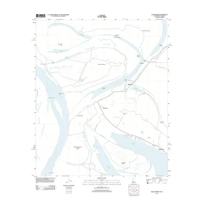
2012 Map of Eagle Bend
USGS Topo · Published 2012About this map
The Mississippi River creates a complex landscape of shifting channels and massive silt-formed landmarks along the border of Mississippi and Louisiana. Deep oxbows and relic riverbeds define the topography, most notably at Eagle Lake, which is bordered by the modern settlements of Brunswick and Eagle Bend. The area is characterized by vast fluvial features such as Henderson Island, Terrapin Neck, and Australia Island, documenting the river's historical meanders. Local history is anchored by small rural centers like Chotard and Bellevule, while the presence of the Brunswick Cem and Kiger Cem provides points of interest for genealogical research. Numerous landings, including Tennessee Landing and Chotard Landing, signify the enduring relationship between the local economy and the river's edge, even as the Brunswick Circle Levee provides modern flood protection for the low-lying terrain.
Find a feature on this map
46 named features on this map. Tap any name to fly to it.
Don’t see what you’re looking for? This feature index may not catch every label — zoom into the map to look around manually.
Map Details
Editions of this 2012 Eagle Bend Map
This is the sole edition of this map. No revisions or reprints were ever made.
Other maps of this area

1909 · Millikens Bend
USGS Topo · 1:24,000

1909 · Tallulah
USGS Topo · 1:24,000

1918 · Vicksburg
USGS Topo · 1:62,500

1939 · Onward
USGS Topo · 1:62,500

1939 · Talla Bena
USGS Topo · 1:62,500

1939 · Alsatia
USGS Topo · 1:62,500

1941 · Vicksburg
USGS Topo · 1:62,500

1955 · Jackson
USGS Topo · 1:250,000

1961 · Jackson
USGS Topo · 1:250,000

1962 · Jackson
USGS Topo · 1:250,000