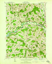
1944 Map of Eagle Bridge
USGS Topo · Published 1958About this map
Eagle Bridge sits at the vital junction of the Hoosic River and the Boston and Maine railroad, serving as a focal point for this 1944 survey of the borderlands between Washington and Rensselaer Counties. The river valley acts as a corridor for transport and settlement, connecting the small villages of Buskirk and East Buskirk. Further into the hills, the rural character of the region is defined by scattered schoolhouses like School No 2 and the isolated Woodside Cem near West Hoosick. The topography is marked by numerous water bodies including Newcomb Pond, Echo Lake, and Golden Pond, which suggest a landscape of glacial depressions. While the river bottom supports the primary rail lines, the surrounding uplands like Oak Hill remain dominated by a patchwork of small farms and crossroads communities like Center White Creek and East Pittstown.
Find a feature on this map
34 named features on this map. Tap any name to fly to it.
Don’t see what you’re looking for? This feature index may not catch every label — zoom into the map to look around manually.
Map Details
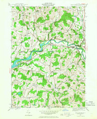
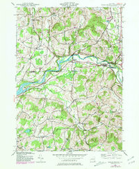
Editions of this 1944 Eagle Bridge Map
3 editions found
Other maps of this area

1893 · Cohoes
USGS Topo · 1:62,500

1895 · Cohoes
USGS Topo · 1:62,500

1895 · Cambridge
USGS Topo · 1:62,500

1897 · Hoosick
USGS Topo · 1:62,500

1898 · Cambridge
USGS Topo · 1:62,500

1898 · Cohoes
USGS Topo · 1:62,500

1900 · Taconic
USGS Topo · 1:125,000

1900 · Schuylerville
USGS Topo · 1:62,500

1901 · Cambridge
USGS Topo · 1:62,500

1903 · Mettawee
USGS Topo · 1:125,000