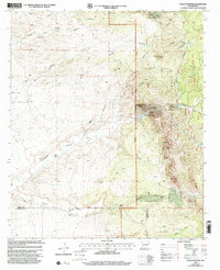
1999 Map of Eagle Eye Peak
USGS Topo · Published 2002About this map
The high desert terrain of the Gila National Forest dominates this landscape, where early ranching and mining efforts left a distinct imprint on the New Mexico borderlands. Working ranches such as Ray Ranch, Cureton Ranch, and McCauley Ranch are established near vital water sources like Burro Spring and the Step Canyon Tank. The geology of the region supported varied extraction activities, evidenced by the Mabie Mine, an Open Pit Mine, and numerous unnamed mine shafts and prospects scattered through the canyons.
Find a feature on this map
44 named features on this map. Tap any name to fly to it.
Don’t see what you’re looking for? This feature index may not catch every label — zoom into the map to look around manually.
Map Details
Editions of this 1999 Eagle Eye Peak Map
This is the sole edition of this map. No revisions or reprints were ever made.
Other maps of this area

1909 · Silver City
USGS Topo · 1:125,000

1950 · Wind Mountain
USGS Topo · 1:24,000

1950 · Burro Peak
USGS Topo · 1:24,000

1951 · Big Burro Mountains
USGS Topo · 1:24,000

1951 · Wind Mountain
USGS Topo · 1:24,000

1954 · Silver City
USGS Topo · 1:250,000

1958 · Silver City
USGS Topo · 1:250,000

1959 · Redrock
USGS Topo · 1:62,500

1962 · Silver City
USGS Topo · 1:250,000

1963 · Gold Hill
USGS Topo · 1:24,000