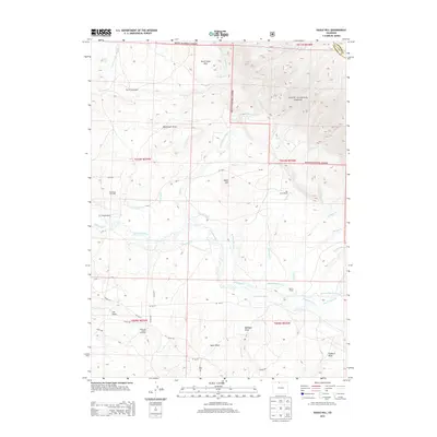
2013 Map of Eagle Hill
USGS Topo · Published 2013About this map
The Canadian River meanders across this landscape in the southern reaches of the Routt National Forest, defining a region where water management is central to both ranching and industry. An intricate network of irrigation systems, including the Medicine Bow Ditch, Stillwater Ditch, and Dwinell Ditch, underscores the effort required to support high-altitude agriculture. The map identifies several named homesteads and operations, such as the Dowell Homestead and the Dwinell Ranch, illustrating the sparse but established settlement pattern of Larimer and Jackson counties.
Find a feature on this map
54 named features on this map. Tap any name to fly to it.
Don’t see what you’re looking for? This feature index may not catch every label — zoom into the map to look around manually.
Map Details
Editions of this 2013 Eagle Hill Map
This is the sole edition of this map. No revisions or reprints were ever made.
Other maps of this area

1950 · Northgate
USGS Topo · 1:24,000

1950 · Kings Canyon
USGS Topo · 1:24,000

1952 · Northgate
USGS Topo · 1:24,000

1952 · Kings Canyon
USGS Topo · 1:24,000

1954 · Craig
USGS Topo · 1:250,000

1955 · Old Roach
USGS Topo · 1:24,000

1955 · Eagle Hill
USGS Topo · 1:24,000

1955 · Shipman Mountain
USGS Topo · 1:24,000

1955 · Gould NW
USGS Topo · 1:24,000

1955 · Walden
USGS Topo · 1:24,000