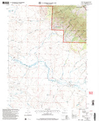
2000 Map of Eagle Hill
USGS Topo · Published 2004About this map
The Canadian River meanders through this Jackson County landscape, defining a valley bordered by the Sand Hills and the rising slopes of the Medicine Bow Range. This 2000 revision, based on earlier surveys, captures a transition from high-desert drainage to protected timberlands within the Routt National Forest and Medicine Bow State Forest. The map documents a landscape of working lands, from the North Mc Callum Oil Field and scattered prospects to established western outposts like the Dowell Homestead and The Horse Ranch. Water management is central to the area's utility, marked by a network of ditches and the Pumping Sta along the river. Numerous draws, including Buffmeyer Draw and Ballinger Draw, feed into the primary river system, illustrating the complex hydrology of this high-altitude basin.
Find a feature on this map
42 named features on this map. Tap any name to fly to it.
Don’t see what you’re looking for? This feature index may not catch every label — zoom into the map to look around manually.
Map Details
Editions of this 2000 Eagle Hill Map
This is the sole edition of this map. No revisions or reprints were ever made.
Other maps of this area

1950 · Northgate
USGS Topo · 1:24,000

1950 · Kings Canyon
USGS Topo · 1:24,000

1952 · Northgate
USGS Topo · 1:24,000

1952 · Kings Canyon
USGS Topo · 1:24,000

1954 · Craig
USGS Topo · 1:250,000

1955 · Old Roach
USGS Topo · 1:24,000

1955 · Eagle Hill
USGS Topo · 1:24,000

1955 · Shipman Mountain
USGS Topo · 1:24,000

1955 · Gould NW
USGS Topo · 1:24,000

1955 · Walden
USGS Topo · 1:24,000