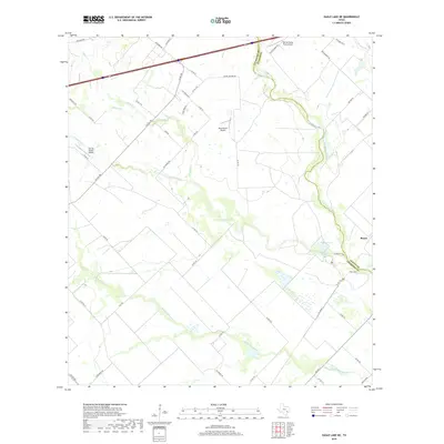
2019 Map of Eagle Lake NE
USGS Topo · Published 2019About this map
The San Bernard River defines the winding eastern boundary of Colorado County in this 2019 survey, tracing a complex riparian corridor as it flows south toward the Gulf Coast. The landscape is marked by a network of drainage systems, including Middle Bernard Cr and Coushatta Cr, which dictate the rural road patterns and property lines of the region. This area remains largely pastoral, characterized by low-lying wetlands and seasonal water bodies like Refuge Lake.
Find a feature on this map
52 named features on this map. Tap any name to fly to it.
Don’t see what you’re looking for? This feature index may not catch every label — zoom into the map to look around manually.
Map Details
Editions of this 2019 Eagle Lake NE Map
This is the sole edition of this map. No revisions or reprints were ever made.
Other maps of this area

1953 · Seguin
USGS Topo · 1:250,000

1956 · Bellville
USGS Topo · 1:62,500

1956 · Sealy
USGS Topo · 1:62,500

1956 · Wallis
USGS Topo · 1:62,500

1957 · Eagle Lake
USGS Topo · 1:62,500

1957 · Altair
USGS Topo · 1:24,000

1958 · Seguin
USGS Topo · 1:250,000

1958 · Bernardo
USGS Topo · 1:24,000

1958 · Alleyton
USGS Topo · 1:24,000

1960 · Lissie
USGS Topo · 1:24,000