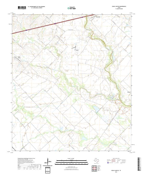
2022 Map of Eagle Lake NE
USGS Topo · Published 2022About this map
The San Bernard River forms the eastern boundary of this landscape, separating Colorado County from Austin County. The terrain is defined by a dense network of drainage channels, including Coushatta Creek and Middle Bernard Cr, which carve through the prairie towards the gulf. The small settlement of Beard sits near the river's edge, highlighting the rural, dispersed nature of the area. A curious mix of private aviation landmarks stands out across the quadrangle, including the uniquely named Mario's Flying Pizza Airport, Renz Ranch Airport, and Dornak Braden Airport.
Find a feature on this map
52 named features on this map. Tap any name to fly to it.
Don’t see what you’re looking for? This feature index may not catch every label — zoom into the map to look around manually.
Map Details
Editions of this 2022 Eagle Lake NE Map
This is the sole edition of this map. No revisions or reprints were ever made.
Other maps of this area

1953 · Seguin
USGS Topo · 1:250,000

1956 · Bellville
USGS Topo · 1:62,500

1956 · Sealy
USGS Topo · 1:62,500

1956 · Wallis
USGS Topo · 1:62,500

1957 · Eagle Lake
USGS Topo · 1:62,500

1957 · Altair
USGS Topo · 1:24,000

1958 · Seguin
USGS Topo · 1:250,000

1958 · Bernardo
USGS Topo · 1:24,000

1958 · Alleyton
USGS Topo · 1:24,000

1960 · Lissie
USGS Topo · 1:24,000