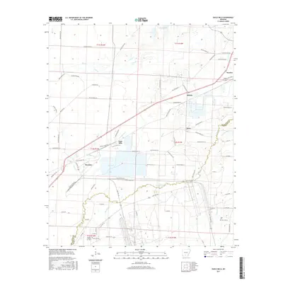
2017 Map of Eagle Mills
USGS Topo · Published 2017About this map
Bearden serves as the primary population center in this contemporary survey of south-central Arkansas, where the Ouachita and Calhoun county lines meet. The landscape is defined by the dense drainage network of the Two Bayou and its tributary, Little Two Bayou, which wind through the southern half of the map. Smaller settlements like Eagle Mills, Millville, and Salem are situated along the roadway corridors, reflecting a historic settlement pattern tied to the region's timber and rail heritage. In the south, Evans Cem provides a specific point of interest for genealogists tracing family roots in the area near Dogwood Cr. The map also details numerous local routes such as Princeton Rd and Bearden-Loop Rd, while water features like Garner Lake Number One and Freeo Cr characterize the low-lying terrain of the coastal plain.
Find a feature on this map
80 named features on this map. Tap any name to fly to it.
Don’t see what you’re looking for? This feature index may not catch every label — zoom into the map to look around manually.
Map Details
Editions of this 2017 Eagle Mills Map
This is the sole edition of this map. No revisions or reprints were ever made.
Other maps of this area

1903 · Camden
USGS Topo · 1:125,000

1951 · Camden
USGS Topo · 1:24,000

1953 · El Dorado
USGS Topo · 1:250,000

1957 · El Dorado
USGS Topo · 1:250,000

1958 · El Dorado
USGS Topo · 1:250,000

1960 · El Dorado
USGS Topo · 1:250,000

1971 · Ouachita
USGS Topo · 1:24,000
1971 · Harmony Grove
USGS Topo · 1:24,000
1971 · Camden
USGS Topo · 1:24,000

1973 · Bearden
USGS Topo · 1:24,000