
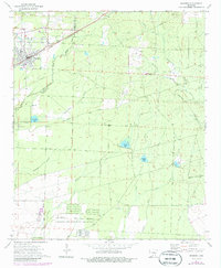
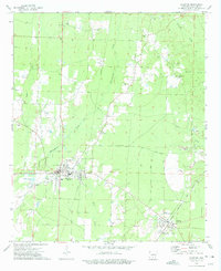
1973 Map of Bearden
USGS Topo · Published 1975About this map
The timberlands and creek bottoms of southern Arkansas are anchored here by the town of Bearden, a community defined by its position along the St Louis Southwestern railroad. This early 1970s survey captures a landscape of transition, where the boundary between Ouachita and Calhoun counties runs through dense woods and scattered small-scale agriculture. Rural life is centered around local institutions like Mt Olive Ch, Macedonia Ch, and the Moss Hill Cem, while the industrial history of the region is evident in the sprawling grounds of the East Camden and Highland Abandoned Ammunition Depot at the southern edge. A complex network of water, including Little Champagnolle Creek and Locust Bayou, drains the low-lying terrain, often flanked by numerous gravel pits that reflect the area's geological utility.
Find a feature on this map
40 named features on this map. Tap any name to fly to it.
Don’t see what you’re looking for? This feature index may not catch every label — zoom into the map to look around manually.
Map Details
Editions of this 1973 Bearden Map
2 editions found
Other maps of this area

1903 · Camden
USGS Topo · 1:125,000

1953 · El Dorado
USGS Topo · 1:250,000

1957 · El Dorado
USGS Topo · 1:250,000

1958 · El Dorado
USGS Topo · 1:250,000

1960 · El Dorado
USGS Topo · 1:250,000

1966 · Fordyce
USGS Topo · 1:24,000
1973 · Eagle Mills
USGS Topo · 1:24,000
1973 · Holly Springs
USGS Topo · 1:24,000
1973 · East Camden
USGS Topo · 1:24,000
1973 · Hampton
USGS Topo · 1:24,000