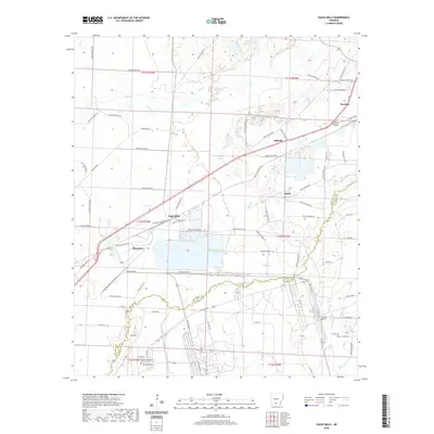
2020 Map of Eagle Mills
USGS Topo · Published 2020About this map
Bearden and the surrounding timberlands of the Gulf Coastal Plain are detailed in this survey, showcasing a landscape defined by meandering creek bottoms and small rail-adjacent communities. The area is characterized by the convergence of several significant watercourses, including Freeo Cr and Two Bayou, which drain the low-lying terrain. The map records the proximity of industrial and educational hubs, specifically the Southern Arkansas University Tech campus located near the Shumaker area, reflecting the region's post-war transition toward technical education and modern industry.
Find a feature on this map
81 named features on this map. Tap any name to fly to it.
Don’t see what you’re looking for? This feature index may not catch every label — zoom into the map to look around manually.
Map Details
Editions of this 2020 Eagle Mills Map
This is the sole edition of this map. No revisions or reprints were ever made.
Other maps of this area

1903 · Camden
USGS Topo · 1:125,000

1951 · Camden
USGS Topo · 1:24,000

1953 · El Dorado
USGS Topo · 1:250,000

1957 · El Dorado
USGS Topo · 1:250,000

1958 · El Dorado
USGS Topo · 1:250,000

1960 · El Dorado
USGS Topo · 1:250,000

1971 · Ouachita
USGS Topo · 1:24,000
1971 · Harmony Grove
USGS Topo · 1:24,000
1971 · Camden
USGS Topo · 1:24,000

1973 · Bearden
USGS Topo · 1:24,000