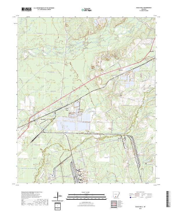
2024 Map of Eagle Mills
USGS Topo · Published 2024About this map
Eagle Mills and Millville occupy the center of this Ouachita County landscape, where the local terrain is defined by the winding paths of Two Bayou and Freeo Creek. The map documents a distinct mix of rural settlement and institutional development, most notably the campus of Southern Arkansas University Tech in the southern portion of the quadrangle. This area, historically shaped by the timber industry and rail access, shows the enduring presence of local landmarks such as Salem Cem and Evans Cem. Small settlements like Shumaker and the outskirts of Bearden are connected by an intricate network of rural roads, including Ouachita Road 287 and Princeton Rd, which follow the contours of the local drainage basins like Mizzell Creek and Brushy Creek.
Find a feature on this map
79 named features on this map. Tap any name to fly to it.
Don’t see what you’re looking for? This feature index may not catch every label — zoom into the map to look around manually.
Map Details
Editions of this 2024 Eagle Mills Map
This is the sole edition of this map. No revisions or reprints were ever made.
Other maps of this area

1903 · Camden
USGS Topo · 1:125,000

1951 · Camden
USGS Topo · 1:24,000

1953 · El Dorado
USGS Topo · 1:250,000

1957 · El Dorado
USGS Topo · 1:250,000

1958 · El Dorado
USGS Topo · 1:250,000

1960 · El Dorado
USGS Topo · 1:250,000

1971 · Ouachita
USGS Topo · 1:24,000
1971 · Harmony Grove
USGS Topo · 1:24,000
1971 · Camden
USGS Topo · 1:24,000

1973 · Bearden
USGS Topo · 1:24,000