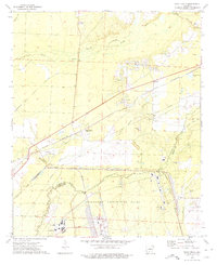
1973 Map of Eagle Mills
USGS Topo · Published 1975About this map
An extensive Abandoned Ammunition Depot dominates the southern landscape of this 1970s survey, marking a significant military footprint between Ouachita and Calhoun counties. The area's industrial character is further defined by the St Louis Southwestern railroad, which services the small settlements of Millville and Eagle Mills. The presence of the State Police Academy and Southwest Technical Institute suggests a mid-century transition toward institutional and educational land use in the wake of former munitions activity.
Find a feature on this map
28 named features on this map. Tap any name to fly to it.
Don’t see what you’re looking for? This feature index may not catch every label — zoom into the map to look around manually.
Map Details
Editions of this 1973 Eagle Mills Map
2 editions found
Other maps of this area

1903 · Camden
USGS Topo · 1:125,000

1951 · Camden
USGS Topo · 1:24,000

1953 · El Dorado
USGS Topo · 1:250,000

1957 · El Dorado
USGS Topo · 1:250,000

1958 · El Dorado
USGS Topo · 1:250,000

1960 · El Dorado
USGS Topo · 1:250,000

1971 · Ouachita
USGS Topo · 1:24,000
1971 · Harmony Grove
USGS Topo · 1:24,000
1971 · Camden
USGS Topo · 1:24,000

1973 · Bearden
USGS Topo · 1:24,000