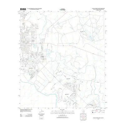
2012 Map of Eagle Pass East
USGS Topo · Published 2012About this map
The Rio Grande forms the western boundary of this South Texas landscape, where the growing residential developments of Eagle Pass meet the agricultural and industrial outskirts of Maverick County. Local history is anchored by Fort Duncan, a site of longstanding military significance near the riverbanks. North of the city center, the community of Seco Mines highlights the region's industrial ties, while further east, the Winn Exploration Co. Inc Airport indicates the infrastructure supporting local energy interests.
Find a feature on this map
132 named features on this map. Tap any name to fly to it.
Don’t see what you’re looking for? This feature index may not catch every label — zoom into the map to look around manually.
Map Details
Editions of this 2012 Eagle Pass East Map
This is the sole edition of this map. No revisions or reprints were ever made.
Other maps of this area
1940 · Eagle Pass
USGS Topo · 1:62,500
1940 · Paloma
USGS Topo · 1:62,500
1940 · Quemado
USGS Topo · 1:62,500
1958 · Eagle Pass
USGS Topo · 1:250,000
1965 · Eagle Pass
USGS Topo · 1:250,000
1974 · Indian Tank
USGS Topo · 1:24,000
1974 · Deadmans Hill
USGS Topo · 1:24,000
1974 · Quemado SE
USGS Topo · 1:24,000
1982 · Eagle Pass NE
USGS Topo · 1:24,000
1983 · Eagle Pass East
USGS Topo · 1:24,000
Featured Places
- Eagle Pass, TX
- Chula Vista, TX
- Las Quintas Fronterizas, TX
- Los Guajillos Colonia, TX
- Morales Number 2 East Colonia, TX