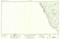
1958 Map of Eagle Pass
USGS Topo · Published 1969About this map
The Rio Grande serves as the dominant geographical and political boundary in this 1960s revision of the Maverick County landscape. At the center of the river valley sits Eagle Pass, a critical international crossing point where the Southern Pacific railroad meets the Mexican border. The map illustrates a developing infrastructure of utility and defense, featuring a Hydroelectric Plant along the river and the Laughlin AFB Aux No 1 airfield to the north.
Find a feature on this map
34 named features on this map. Tap any name to fly to it.
Don’t see what you’re looking for? This feature index may not catch every label — zoom into the map to look around manually.
Map Details
Editions of this 1958 Eagle Pass Map
2 editions found

Other maps of this area

1896 · Brackett
USGS Topo · 1:125,000

1897 · Brackett
USGS Topo · 1:125,000

1898 · Uvalde
USGS Topo · 1:125,000

1899 · Uvalde
USGS Topo · 1:125,000

1923 · Palafox
USGS Topo · 1:62,500

1929 · Cotulla
USGS Topo · 1:125,000

1939 · Carrizo Springs
USGS Topo · 1:62,500

1939 · La Pryor
USGS Topo · 1:62,500

1940 · Asherton
USGS Topo · 1:62,500

1940 · San Loranzo Creek
USGS Topo · 1:62,500