
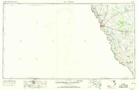
1958 Map of Eagle Pass
USGS Topo · Published 1969About this map
The Rio Grande serves as the defining border for this South Texas landscape, where the international passage between Eagle Pass and Piedras Negras anchors the region's movement. In the late 1950s, the terrain shows a sophisticated network of water management, evidenced by the Maverick Canal and Numerous small dams scattered across the arid brushland. This infrastructure supported a ranching economy where family-named holdings like Pickens-Coitfield Ranch and Farias Ranch established the local footprint alongside the industrial presence of Oil wells and the Chittim Lease.
Find a feature on this map
37 named features on this map. Tap any name to fly to it.
Don’t see what you’re looking for? This feature index may not catch every label — zoom into the map to look around manually.
Map Details
Editions of this 1958 Eagle Pass Map
2 editions found
Other maps of this area

1896 · Brackett
USGS Topo · 1:125,000

1897 · Brackett
USGS Topo · 1:125,000

1898 · Uvalde
USGS Topo · 1:125,000

1899 · Uvalde
USGS Topo · 1:125,000

1923 · Palafox
USGS Topo · 1:62,500

1929 · Cotulla
USGS Topo · 1:125,000

1939 · Carrizo Springs
USGS Topo · 1:62,500

1939 · La Pryor
USGS Topo · 1:62,500

1940 · Asherton
USGS Topo · 1:62,500

1940 · San Loranzo Creek
USGS Topo · 1:62,500