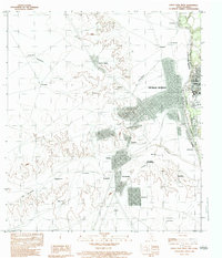
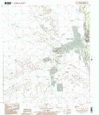
1983 Map of Eagle Pass West
USGS Topo · Published 1983About this map
The Rio Bravo Rio Grande serves as the international border between Texas and Coahuila in this 1983 provisional survey, connecting the urban centers of Eagle Pass and Piedras Negras. The map provides a detailed view of the transition from the Maverick County riverfront into the Mexican interior, where the grid-patterned streets of the city give way to a network of smaller communities and agricultural outposts. South and west of the main city center, settlements like Fuentes, San Joaquin, and Doctores sit along the winding path of the Rio Escondido. Numerous family-named landmarks and smaller locales such as Santa Maria de Guadalupe, El Sacrificio, and La Tinajita are scattered across the terrain, reflecting the decentralized settlement patterns of the region. Transportation and transit points are noted by several landing strips and a developed road network leading away from the international crossing.
Find a feature on this map
37 named features on this map. Tap any name to fly to it.
Don’t see what you’re looking for? This feature index may not catch every label — zoom into the map to look around manually.
Map Details
Editions of this 1983 Eagle Pass West Map
2 editions found
Other maps of this area

1940 · Eagle Pass
USGS Topo · 1:62,500

1940 · Paloma
USGS Topo · 1:62,500

1940 · Quemado
USGS Topo · 1:62,500

1958 · Eagle Pass
USGS Topo · 1:250,000

1965 · Eagle Pass
USGS Topo · 1:250,000
1974 · Deadmans Hill
USGS Topo · 1:24,000
1974 · Quemado SE
USGS Topo · 1:24,000
1983 · Eagle Pass East
USGS Topo · 1:24,000
1983 · Eagle Pass West
USGS Topo · 1:24,000
1983 · Eagle Pass SW
USGS Topo · 1:24,000