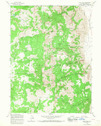
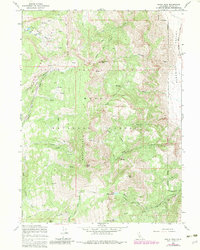
1963 Map of Eagle Peak
USGS Topo · Published 1968About this map
Eagle Peak dominates the center of this 1963 survey, standing as a prominent landmark within the Modoc National Forest. This high-altitude landscape is characterized by a series of significant heights, including Dusenbery Peak, Cole Peak, and Bald Mtn, which define the drainage basins for numerous seasonal and perennial water sources. The map captures the remote transition from the steep timbered slopes of the Saddleback down toward the western edge of Surprise Valley.
Find a feature on this map
33 named features on this map. Tap any name to fly to it.
Don’t see what you’re looking for? This feature index may not catch every label — zoom into the map to look around manually.
Map Details
Editions of this 1963 Eagle Peak Map
5 editions found
Other maps of this area

1886 · Alturas
USGS Topo · 1:250,000

1892 · Alturas
USGS Topo · 1:250,000

1954 · Alturas
USGS Topo · 1:250,000

1958 · Alturas
USGS Topo · 1:250,000

1962 · Alturas
USGS Topo · 1:250,000

1962 · Snake Lake
USGS Topo · 1:24,000

1962 · Jess Valley
USGS Topo · 1:24,000
1962 · Emerson Peak
USGS Topo · 1:24,000

1963 · Warren Peak
USGS Topo · 1:24,000
1963 · Hansen Island
USGS Topo · 1:24,000