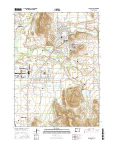
2017 Map of Eagle Point
USGS Topo · Published 2017About this map
The Rogue River flows through the northwest corner of this Jackson County landscape, characterized by a sophisticated network of water management features including the Medford Irrigation District Canal and Crater Canal. Centered on the growing hub of Eagle Point and the industrial layout of White City, the map reveals a transition from valley floor to rising terrain such as Young Hill and the Rader Hills. This 2017 record details the convergence of rural infrastructure and residential expansion, with numerous water storage sites like Agate Reservoir, Barton Reservoir, and the Hoover Reservoirs supporting the region's agricultural and civil needs. Genealogists will find interest in the documented locations of the Veterans Cem, Antelope Cem, and Nichols Cem, providing clear markers of the community's long-standing roots.
Find a feature on this map
154 named features on this map. Tap any name to fly to it.
Don’t see what you’re looking for? This feature index may not catch every label — zoom into the map to look around manually.
Map Details
Editions of this 2017 Eagle Point Map
This is the sole edition of this map. No revisions or reprints were ever made.
Other maps of this area

1891 · Ashland
USGS Topo · 1:250,000

1893 · Ashland
USGS Topo · 1:250,000

1897 · Ashland
USGS Topo · 1:250,000

1938 · Medford
USGS Topo · 1:125,000

1943 · Trail
USGS Topo · 1:62,500

1954 · Medford
USGS Topo · 1:62,500

1954 · Butte Falls
USGS Topo · 1:62,500

1954 · Lakecreek
USGS Topo · 1:62,500

1955 · Medford
USGS Topo · 1:250,000

1957 · Medford
USGS Topo · 1:250,000