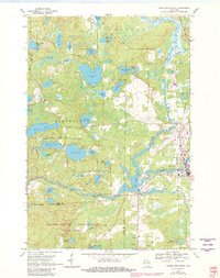
1970 Map of Eagle River West
USGS Topo · Published 1982About this map
Watersmeet Lake and the winding Wisconsin River dominate this pocket of the Northwoods, where water and forest define the landscape of the 1970s. The regional hub of Eagle River appears on the eastern edge of the sheet, served by the Chicago and North Western railroad and the Eagle River Union Airport. Hydroelectric infrastructure is evident at the Otter Rapids Dam and its associated Powerhouse, which harnessed the river's flow downstream from the larger lakes.
Find a feature on this map
65 named features on this map. Tap any name to fly to it.
Don’t see what you’re looking for? This feature index may not catch every label — zoom into the map to look around manually.
Map Details
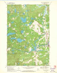
Editions of this 1970 Eagle River West Map
2 editions found
Other maps of this area

1928 · Three Lakes
USGS Topo · 1:48,000

1930 · Robbins
USGS Topo · 1:48,000

1938 · Phelps
USGS Topo · 1:48,000

1938 · Three Lakes
USGS Topo · 1:48,000

1938 · Robbins
USGS Topo · 1:48,000

1945 · Three Lakes
USGS Topo · 1:48,000

1945 · Robbins
USGS Topo · 1:48,000

1946 · Star Lake
USGS Topo · 1:48,000

1950 · Phelps
USGS Topo · 1:48,000

1950 · Star Lake
USGS Topo · 1:48,000