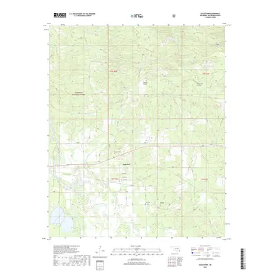
2018 Map of Eagletown
USGS Topo · Published 2018About this map
The Eagletown settlement and its surrounding bottomlands are defined by the winding course of the Mountain Fork river and the northern reaches of the Ouachita National Forest. This 2018 survey documents a landscape of transition where the dense timber of the national forest meets open clearings like Winship Prairie and Racetrack Prairie. For genealogists and local historians, the map identifies three distinct burial sites: Eagletown Cem, Tonka Cem, and Mountain Fork Cem, which provide essential points of reference for tracing family roots in McCurtain County. The hydrography of the region is particularly dense, featuring complex drainage patterns through Crooked Cr, Liksuklo Cr, and the secluded waters of Grassy Lake. Local landmarks like Presbyterian Falls and historical road names such as the Choctaw Hwy and Mad Man Rd reflect the unique cultural and geographic identity of this corner of southeastern Oklahoma.
Find a feature on this map
36 named features on this map. Tap any name to fly to it.
Don’t see what you’re looking for? This feature index may not catch every label — zoom into the map to look around manually.
Map Details
Editions of this 2018 Eagletown Map
This is the sole edition of this map. No revisions or reprints were ever made.
Other maps of this area

1902 · Lukfata
USGS Topo · 1:125,000

1913 · De Queen
USGS Topo · 1:125,000

1950 · Mcalester
USGS Topo · 1:250,000

1950 · Shults
USGS Topo · 1:24,000

1950 · Goodwater
USGS Topo · 1:24,000

1951 · Shults
USGS Topo · 1:24,000

1951 · Goodwater
USGS Topo · 1:24,000

1951 · Cerrogordo
USGS Topo · 1:24,000

1953 · Texarkana
USGS Topo · 1:250,000

1956 · Texarkana
USGS Topo · 1:250,000