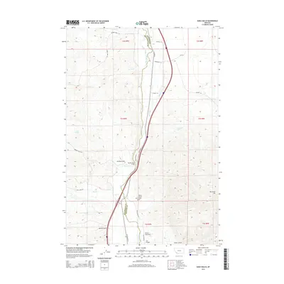
2014 Map of Earls Gulch
USGS Topo · Published 2014About this map
The Big Hole River winds through the borderlands of Beaverhead and Madison Counties in this 2014 survey. The river corridor is the primary artery for local travel, crossed by the Big Hole River Bridge and paralleled by Highway 91. To the east, the landscape rises toward the prominent McCartney Mtn, while the western terrain is dissected by numerous drainage features including Brownes Gulch, Dry Timber Gulch, and Sassman Gulch. Evidence of the region's ranching and natural resource history is found in the naming of remote tracks like Kalsta Ranch Rd and landmarks such as the Devils Dancehall. Isolated water sources like Kambich Springs and Cottonwood Spring provide critical points of interest in this high-elevation landscape of canyons and gulches.
Find a feature on this map
38 named features on this map. Tap any name to fly to it.
Don’t see what you’re looking for? This feature index may not catch every label — zoom into the map to look around manually.
Map Details
Editions of this 2014 Earls Gulch Map
This is the sole edition of this map. No revisions or reprints were ever made.
Other maps of this area

1893 · Dillon
USGS Topo · 1:250,000

1952 · Twin Adams Mountain
USGS Topo · 1:24,000

1955 · Dillon
USGS Topo · 1:250,000

1957 · Dillon
USGS Topo · 1:250,000

1958 · Dillon
USGS Topo · 1:250,000

1958 · Vipond Park
USGS Topo · 1:62,500

1960 · Glen
USGS Topo · 1:24,000

1960 · Block Mountain
USGS Topo · 1:24,000

1961 · Melrose
USGS Topo · 1:24,000

1961 · Earls Gulch
USGS Topo · 1:24,000