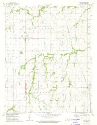
1973 Map of Earlton
USGS Topo · Published 1975About this map
Earlton and the surrounding prairies of Neosho County are defined by a network of small watercourses and competing rail lines in the early 1970s. The landscape is carved by the winding paths of Turkey Creek, Elk Creek, and Little Elk Creek, with smaller drainages like Mud Creek and Chetopa Cr crossing the fertile bottomlands. Local industry and utility are evident through numerous Oil Wells, an active Oil Field, and a localized Gravel Pit.
Find a feature on this map
21 named features on this map. Tap any name to fly to it.
Don’t see what you’re looking for? This feature index may not catch every label — zoom into the map to look around manually.
Map Details
Editions of this 1973 Earlton Map
2 editions found
Other maps of this area

1886 · Fredonia
USGS Topo · 1:125,000

1886 · Iola
USGS Topo · 1:125,000

1886 · Independence
USGS Topo · 1:125,000

1886 · Parsons
USGS Topo · 1:125,000

1893 · Iola
USGS Topo · 1:125,000

1893 · Parsons
USGS Topo · 1:125,000

1894 · Fredonia
USGS Topo · 1:125,000

1894 · Independence
USGS Topo · 1:125,000

1904 · Iola
USGS Topo · 1:125,000

1905 · Independence
USGS Topo · 1:125,000