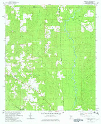
1982 Map of Earlville
USGS Topo · Published 1982About this map
The Escatawpa River defines the borderlands of Mobile and George counties in the early 1980s, where a network of rural churches and family landmarks anchor the community. The landscape is marked by the Illinois Central Gulf railroad line, which runs through the southern reaches near Shipman. Small settlements like Earlville and Luce are nestled among a complex system of waterways, including Brushy Creek and Beaver Creek. Local history is preserved through scattered burial grounds and places of worship, such as the Moffet Cem and Macedonia Ch. The presence of several Sandpit sites indicates the area's geological utility, while the Roadside Park along the highway provides a point of public interest in this primarily timbered and riparian terrain.
Find a feature on this map
26 named features on this map. Tap any name to fly to it.
Don’t see what you’re looking for? This feature index may not catch every label — zoom into the map to look around manually.
Map Details
Editions of this 1982 Earlville Map
3 editions found
Other maps of this area

1941 · Lucedale
USGS Topo · 1:62,500

1942 · Deer Park
USGS Topo · 1:62,500

1942 · Wilmer
USGS Topo · 1:62,500

1943 · Lucedale
USGS Topo · 1:62,500

1943 · Deer Park
USGS Topo · 1:62,500

1944 · Wilmer
USGS Topo · 1:62,500

1953 · Hattiesburg
USGS Topo · 1:250,000

1953 · Mobile
USGS Topo · 1:250,000

1957 · Mobile
USGS Topo · 1:250,000

1958 · Hattiesburg
USGS Topo · 1:250,000