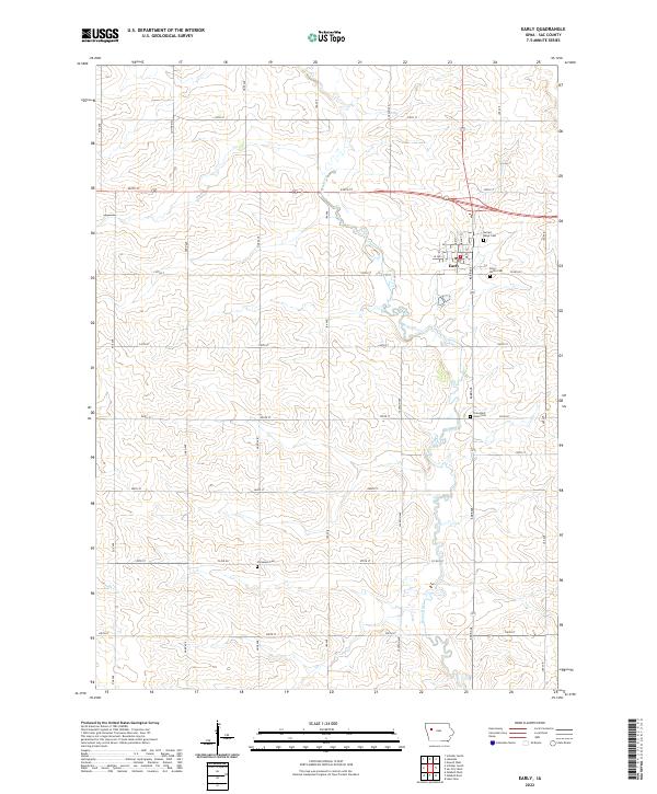
2022 Map of Early
USGS Topo · Published 2022About this map
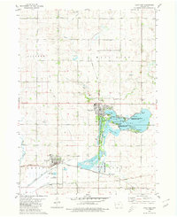
The town of Early serves as the focal point for this Sac County landscape, where the agricultural grid of Northwest Iowa is interrupted by the meandering course of the Boyer River. The township lines for t88n r37w and t89n r37w converge near the settlement, which maintains a concentrated cluster of streets like Main St and Walnut St. This modern survey illustrates the persistent importance of local burial grounds and churches to the community's identity, documenting several distinct sites including Sacred Heart Cem, Early Union Cem, and Protestant Union Cem. Outside the town center, the land is defined by a rigorous network of section roads like 240th St and Ira Ave, punctuated by smaller waterways such as Elk Cr and the rural Immanuel Cem.
Find a feature on this map
37 named features on this map. Tap any name to fly to it.
Don’t see what you’re looking for? This feature index may not catch every label — zoom into the map to look around manually.
Map Details
Editions of this 2022 Early Map
This is the sole edition of this map. No revisions or reprints were ever made.
Other maps of this area

1954 · Fort Dodge
USGS Topo · 1:250,000

1957 · Fort Dodge
USGS Topo · 1:250,000

1958 · Fort Dodge
USGS Topo · 1:250,000
1979 · Lakeside
USGS Topo · 1:24,000
1979 · Newell West
USGS Topo · 1:24,000
1979 · Schaller North
USGS Topo · 1:24,000
1980 · Odebolt East
USGS Topo · 1:24,000
1980 · Early
USGS Topo · 1:24,000
1980 · Lake View
USGS Topo · 1:24,000
1980 · Sac City West
USGS Topo · 1:24,000