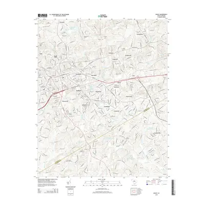
2014 Map of Easley
USGS Topo · Published 2014About this map
The city of Easley serves as the hub of this early 21st-century landscape, where the residential expansion of communities like Pickensville and Powdersville meets the legacy of the region's agricultural and industrial roots. The map documents a complex network of suburban developments including Timberlane, Smithfields, and Yorkwood, situated between the headwaters of Eighteenmile Creek and Brushy Creek. Genealogists and local historians will find significant value in the numerous recorded burial sites, such as the Easley Mill Cemetery and the Corinth Baptist Number Two Cemetery. In the northern reaches, the terrain rises toward Arial Mountain and the settlement of Montague, while the Williamsport Airpark and Georges Creek Watershed Structure reflect modern infrastructure and land management. The winding courses of Three and Twenty Creek and Burdine Creek define the drainage patterns of this Upstate South Carolina corridor.
Find a feature on this map
65 named features on this map. Tap any name to fly to it.
Don’t see what you’re looking for? This feature index may not catch every label — zoom into the map to look around manually.
Map Details
Editions of this 2014 Easley Map
This is the sole edition of this map. No revisions or reprints were ever made.
Other maps of this area

1888 · Pickens
USGS Topo · 1:125,000

1894 · Pickens
USGS Topo · 1:125,000

1935 · Greenville
USGS Topo · 1:48,000

1938 · Greenville
USGS Topo · 1:62,500

1954 · Greenville
USGS Topo · 1:250,000

1957 · Greenville
USGS Topo · 1:24,000

1957 · Anderson
USGS Topo · 1:62,500

1957 · Easley
USGS Topo · 1:62,500

1957 · Williamston
USGS Topo · 1:62,500

1957 · Greenville
USGS Topo · 1:62,500