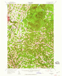
1957 Map of East Barre
USGS Topo · Published 1959About this map
Groton State Forest and Washington State Forest dominate the high ground of this central Vermont landscape, where the granite industry shaped the physical and social geography of the late 1950s. The dense settlement pattern around Websterville, Graniteville, and Upper Graniteville underscores the importance of the local quarries, specifically those situated on Millstone Hill. This industrial cluster contrasts with the rural character of the Knox Mountains and the dispersed farming communities to the south.
Find a feature on this map
96 named features on this map. Tap any name to fly to it.
Don’t see what you’re looking for? This feature index may not catch every label — zoom into the map to look around manually.
Map Details
Editions of this 1957 East Barre Map
4 editions found
Other maps of this area

1896 · Strafford
USGS Topo · 1:62,500

1919 · Royalton
USGS Topo · 1:62,500

1919 · Montpelier
USGS Topo · 1:62,500

1921 · Montpelier
USGS Topo · 1:62,500

1922 · Barre
USGS Topo · 1:48,000

1924 · Barre
USGS Topo · 1:62,500

1924 · Randolph
USGS Topo · 1:48,000

1926 · Randolph
USGS Topo · 1:62,500

1931 · Mt. Cube
USGS Topo · 1:62,500

1931 · Woodsville
USGS Topo · 1:48,000