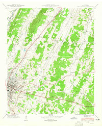
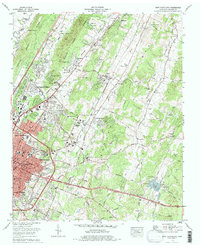
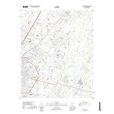
1943 Map of East Cleveland
USGS Topo · Published 1946About this map
The ridge and valley landscape of Bradley County comes into focus in this 1943 survey, centered on the expansion of Cleveland and the rural communities to its east. The industrial and residential core of North Cleveland and East Cleveland is grounded by the Southern railway line, which cuts northeast toward Tasso. Rural life is anchored by a dense network of country schools and churches, including the Michigan Avenue School and the New Friendship Ch., many of which are paired with family burial grounds such as the Ramsey Cem and Perkle Cem. To the north, Haun Mill sits along the slopes of Dry Valley Ridge, highlighting the early agricultural infrastructure of the Tennessee Valley before mid-century modernization. The topography is defined by parallel ridges and the winding courses of South Mouse Creek and Chatata Creek, which shaped the placement of early homesteads and road networks.
Find a feature on this map
49 named features on this map. Tap any name to fly to it.
Don’t see what you’re looking for? This feature index may not catch every label — zoom into the map to look around manually.
Map Details
Editions of this 1943 East Cleveland Map
2 editions found
Historical Maps of Cleveland Through Time
9 maps found
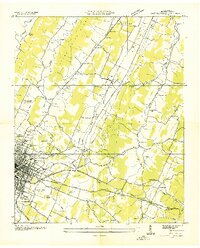
1935 East Cleveland
Bradley County, TN
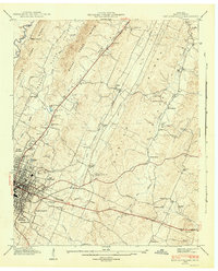
1943 East Cleveland
Bradley County, TN
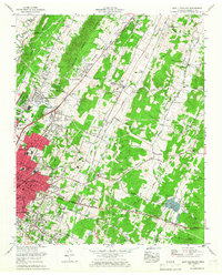
1965 East Cleveland
Bradley County, TN
1976 East Cleveland
Bradley County, TN
2010 East Cleveland
Bradley County, TN
2013 East Cleveland
Bradley County, TN
2016 East Cleveland
Bradley County, TN
2019 East Cleveland
Bradley County, TN
2022 East Cleveland
Bradley County, TN