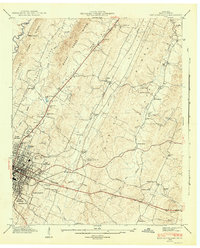
1943 Map of East Cleveland
USGS Topo · Published 1965About this map
The ridge and valley system of Bradley County dictates the layout of this 1943 survey, where Walker Ridge and Beeler Ridge channel the flow of Chatata Creek and South Mouse Creek. The industrial and residential core of Cleveland and East Cleveland anchors the southwestern quadrant, showing a dense street grid and the Southern Railway corridor. Away from the city center, the landscape is defined by small rural hubs such as Tasso and numerous family and community landmarks.
Find a feature on this map
49 named features on this map. Tap any name to fly to it.
Don’t see what you’re looking for? This feature index may not catch every label — zoom into the map to look around manually.
Map Details
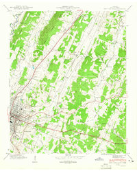
Editions of this 1943 East Cleveland Map
2 editions found
Other maps of this area

1886 · Cleveland
USGS Topo · 1:125,000

1892 · Cleveland
USGS Topo · 1:125,000

1895 · Cleveland
USGS Topo · 1:125,000

1901 · Cleveland
USGS Topo · 1:125,000

1935 · East Cleveland
USGS Topo · 1:24,000

1935 · Mc Donald
USGS Topo · 1:24,000

1935 · Calhoun
USGS Topo · 1:24,000

1935 · Benton
USGS Topo · 1:24,000

1935 · Felker
USGS Topo · 1:24,000

1935 · Charleston
USGS Topo · 1:24,000