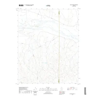
2019 Map of East Dry Creek
USGS Topo · Published 2019About this map
The Canadian River dominates the northern landscape of this Texas Panhandle quadrangle, carving a wide valley through the high plains at the border of Roberts and Hemphill counties. This environment is defined by its drainage systems, where ephemeral streams like Home Ranch Cr and Barton Cr feed into the river's braided channel. South of the river, the terrain breaks into a complex network of ridges and canyons, particularly around the headwaters of E Dry Cr.
Find a feature on this map
16 named features on this map. Tap any name to fly to it.
Don’t see what you’re looking for? This feature index may not catch every label — zoom into the map to look around manually.
Map Details
Editions of this 2019 East Dry Creek Map
This is the sole edition of this map. No revisions or reprints were ever made.
Other maps of this area
1954 · Perryton
USGS Topo · 1:250,000
1954 · Amarillo
USGS Topo · 1:250,000
1958 · Perryton
USGS Topo · 1:250,000
1958 · Amarillo
USGS Topo · 1:250,000
1967 · Mendota
USGS Topo · 1:24,000
1972 · Washburn Arroyo
USGS Topo · 1:24,000
1972 · Horse Creek North
USGS Topo · 1:24,000
1972 · Canadian West
USGS Topo · 1:24,000
1972 · East Dry Creek
USGS Topo · 1:24,000
1972 · Horse Creek South
USGS Topo · 1:24,000