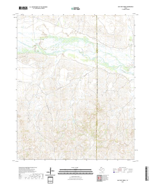
2022 Map of East Dry Creek
USGS Topo · Published 2022About this map
The Canadian River meanders across the northern half of this Texas Panhandle landscape, where the braided riverbed meets a network of rugged canyons and draws. This region, straddling the Roberts and Hemphill County line, is defined by water sources critical to the local ranching economy. Named features like Jim Waterfield Lake and the nearby Waterfield Springs signify the importance of reliable water in this arid environment, while a sparse grid of ranch roads like Quarter Horse Rd and S Camp Rd provide the only access across the dissected breaks. Several tributaries, including Horse Ranch Cr, Hackberry Cr, and Barton Cr, feed into the main river channel, illustrating the drainage patterns that have shaped the local topography. This map documents a contemporary view of a remote cattle-country landscape where geographic naming often reflects long-standing family ranching operations.
Find a feature on this map
16 named features on this map. Tap any name to fly to it.
Don’t see what you’re looking for? This feature index may not catch every label — zoom into the map to look around manually.
Map Details
Editions of this 2022 East Dry Creek Map
This is the sole edition of this map. No revisions or reprints were ever made.
Other maps of this area

1954 · Perryton
USGS Topo · 1:250,000

1954 · Amarillo
USGS Topo · 1:250,000

1958 · Perryton
USGS Topo · 1:250,000

1958 · Amarillo
USGS Topo · 1:250,000

1967 · Mendota
USGS Topo · 1:24,000

1972 · Washburn Arroyo
USGS Topo · 1:24,000

1972 · Horse Creek North
USGS Topo · 1:24,000

1972 · Canadian West
USGS Topo · 1:24,000

1972 · East Dry Creek
USGS Topo · 1:24,000
1972 · Horse Creek South
USGS Topo · 1:24,000