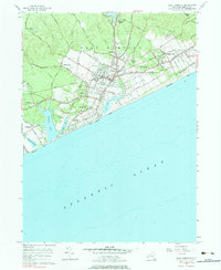
1956 Map of East Hampton
USGS Topo · Published 1984About this map
East Hampton and its neighboring villages are captured in mid-century detail, showcasing a landscape defined by its coastal orientation and historic inland settlements. The Long Island Railroad cuts a straight path through the territory, linking Amagansett and Pantigo to the west. Along the shoreline, prominent water bodies such as Georgica Pond, Hook Pond, and Wainscott Pond sit behind the protective barrier of Amagansett Beach and Wainscott Beach.
Find a feature on this map
64 named features on this map. Tap any name to fly to it.
Don’t see what you’re looking for? This feature index may not catch every label — zoom into the map to look around manually.
Map Details
Editions of this 1956 East Hampton Map
4 editions found
Other maps of this area

1903 · Sag Harbor
USGS Topo · 1:62,500

1903 · Gardiners Island
USGS Topo · 1:62,500

1904 · Sag Harbor
USGS Topo · 1:62,500

1904 · Shelter Island
USGS Topo · 1:62,500

1904 · Easthampton
USGS Topo · 1:62,500

1904 · Gardiners Island
USGS Topo · 1:62,500

1921 · Gardiners Island
USGS Topo · 1:62,500

1921 · Easthampton
USGS Topo · 1:62,500

1943 · Gardiners Island East
USGS Topo · 1:24,000

1944 · Gardiners Island West
USGS Topo · 1:24,000
Featured Places
- Southampton, NY
- East Hampton, NY
- Springs, East Hampton
- East Hampton North, East Hampton
- Northwest Harbor, East Hampton