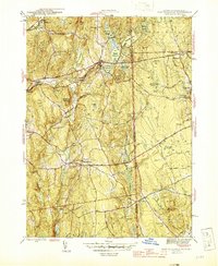
1945 Map of East Killingly
USGS Topo · Published 1945About this map
The Connecticut-Rhode Island border divides this 1945 landscape, where the textile-industrial heritage of Windham County meets the upland swamps and high ridges of Providence County. A chain of man-made water bodies including Bog Meadow Reservoir, Eddy Pray Reservoir, and Killingly Pond illustrates the intensive water management required for regional mills. The village of East Killingly sits at a central crossroads, while smaller settlements like Ballouville and Elliotville dot the valleys of the Fivemile River and Whetstone Brook. The eastern terrain is defined by significant elevations like Jerimoth Hill and Mt Hygeia, where rural life is evidenced by the Mt Hygeia School and family landmarks such as Hopkins Cemetery. This survey captures the area just before the mid-century shift away from these established rural and mill-town patterns, preserving the locations of the Hartford and Providence Pike and numerous local woods roads.
Find a feature on this map
56 named features on this map. Tap any name to fly to it.
Don’t see what you’re looking for? This feature index may not catch every label — zoom into the map to look around manually.
Map Details
Editions of this 1945 East Killingly Map
2 editions found
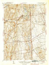
Other maps of this area

1889 · Putnam
USGS Topo · 1:62,500

1889 · Burrillville
USGS Topo · 1:62,500

1889 · Moosup
USGS Topo · 1:62,500

1890 · Kent
USGS Topo · 1:62,500

1893 · Putnam
USGS Topo · 1:62,500

1893 · Moosup
USGS Topo · 1:62,500

1894 · Burrillville
USGS Topo · 1:62,500

1894 · Kent
USGS Topo · 1:62,500

1915 · Burrillville
USGS Topo · 1:62,500

1919 · Putnam
USGS Topo · 1:62,500