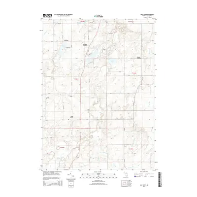
2014 Map of East Leroy
USGS Topo · Published 2014About this map
East Leroy and the surrounding rural townships of southern Calhoun County are defined by a network of family-named cemeteries and small agricultural junctions. This 2014 survey captures the landscape south of Battle Creek, where the terrain is drained by Nottawa Cr and Pine Cr. Genealogical value is high across this quadrangle, as it meticulously identifies several burial grounds including Morgan Cem, Mather Cem, German Cem, Abscota Cem, and Walker Cem. Local road patterns connect historic nodes like Sonoma, Morgan Corners, and Stanley Corners. The presence of numerous drains and brooks, such as the Miller and Melody Drain and Waterman Drain, illustrates the managed hydrology necessary for the region's agricultural productivity. Shoreline developments are visible around Graham Lake and Sonoma Lake, reflecting the shift from purely agrarian uses to modern residential recreation.
Find a feature on this map
72 named features on this map. Tap any name to fly to it.
Don’t see what you’re looking for? This feature index may not catch every label — zoom into the map to look around manually.
Map Details
Editions of this 2014 East Leroy Map
This is the sole edition of this map. No revisions or reprints were ever made.
Other maps of this area

1918 · Battle Creek
USGS Topo · 1:62,500

1918 · Union City
USGS Topo · 1:62,500

1918 · Galesburg
USGS Topo · 1:62,500

1918 · Leonidas
USGS Topo · 1:62,500

1943 · Battle Creek
USGS Topo · 1:62,500

1944 · Leonidas
USGS Topo · 1:62,500

1944 · Galesburg
USGS Topo · 1:62,500

1947 · Augusta
USGS Topo · 1:24,000

1947 · Ceresco
USGS Topo · 1:24,000

1947 · Battle Creek
USGS Topo · 1:24,000