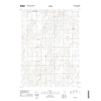
2019 Map of East Leroy
USGS Topo · Published 2019About this map
East Leroy and Sonoma anchor this southern Calhoun County landscape, where the agricultural plains are punctuated by a dense network of glacial lakes and winding creeks. The map documents a classic Midwestern township structure, defined by a grid of rural roads like Sonoma Rd and Capital Ave SW that connect small crossroads settlements such as Joppa and Stanley Corners. This era reveals a well-preserved record of local family history through its numerous small burial grounds, including the Mather-Voyce Cem and Walker Cem. The hydrology is particularly intricate, with Sonoma Lake, Graham Lake, and Cotton Lake forming a chain of water bodies linked by the headwaters of Pine Creek and Nottawa Cr. The presence of man-made drainage systems like the Miller and Melody Drain among natural features like Minges Brook illustrates the ongoing management of the region's fertile but wet lowlands.
Find a feature on this map
79 named features on this map. Tap any name to fly to it.
Don’t see what you’re looking for? This feature index may not catch every label — zoom into the map to look around manually.
Map Details
Editions of this 2019 East Leroy Map
This is the sole edition of this map. No revisions or reprints were ever made.
Other maps of this area

1918 · Battle Creek
USGS Topo · 1:62,500

1918 · Union City
USGS Topo · 1:62,500

1918 · Galesburg
USGS Topo · 1:62,500

1918 · Leonidas
USGS Topo · 1:62,500

1943 · Battle Creek
USGS Topo · 1:62,500

1944 · Leonidas
USGS Topo · 1:62,500

1944 · Galesburg
USGS Topo · 1:62,500

1947 · Augusta
USGS Topo · 1:24,000

1947 · Ceresco
USGS Topo · 1:24,000

1947 · Battle Creek
USGS Topo · 1:24,000