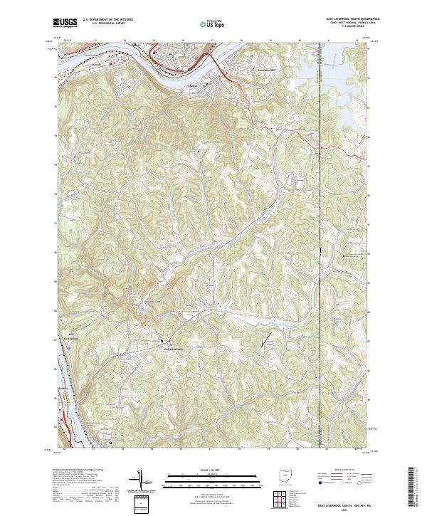
2023 Map of East Liverpool South
USGS Topo · Published 2023About this map
The Ohio River curves around the industrial and residential corridors of Newell, Chester, and New Manchester in this modern survey of the tri-state border region. The landscape transitions from the riverbank infrastructure to the high ground of Stewart Hill and the protected waters of Tomlinson Lake. This area is defined by its complex waterway network, including the North Fork Tomlinson Run and Hardin Run, which have historically shaped the settlement patterns and transport routes through Shepherds Valley.
Find a feature on this map
168 named features on this map. Tap any name to fly to it.
Don’t see what you’re looking for? This feature index may not catch every label — zoom into the map to look around manually.
Map Details
Editions of this 2023 East Liverpool South Map
This is the sole edition of this map. No revisions or reprints were ever made.
Other maps of this area

1901 · Beaver
USGS Topo · 1:62,500

1904 · Wellsville
USGS Topo · 1:62,500

1904 · Steubenville
USGS Topo · 1:62,500

1904 · Beaver
USGS Topo · 1:62,500

1904 · Burgettstown
USGS Topo · 1:62,500

1906 · Burgettstown
USGS Topo · 1:62,500

1935 · Steubenville
USGS Topo · 1:62,500

1937 · Wellsville
USGS Topo · 1:62,500

1942 · Steubenville
USGS Topo · 1:62,500

1944 · Wellsville
USGS Topo · 1:62,500