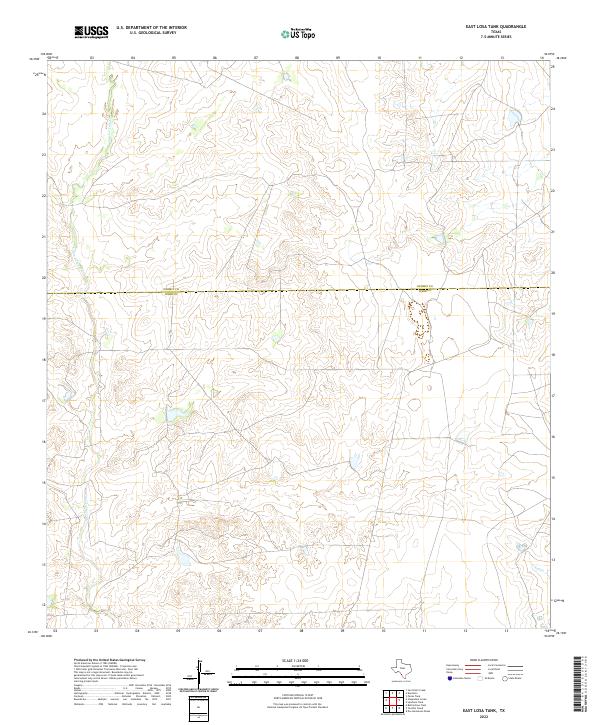
2022 Map of East Losa Tank
USGS Topo · Published 2022About this map
San Lorenzo Creek defines the western reaches of this South Texas landscape, where ephemeral waterways weave through the brush country. The map depicts a sparse, rural area along the Dimmit Co and Webb Co border, a region historically dominated by large ranching interests and oil and gas activity. The terrain is relatively low-lying, characterized by the subtle elevation changes of the Espejo region. This survey captures the modern road network and water management features, including several tanks and impoundments common to this arid environment, providing an essential record of the local hydrology and boundary lines in a part of the state where water and land ownership are deeply intertwined.
Find a feature on this map
3 named features on this map. Tap any name to fly to it.
Don’t see what you’re looking for? This feature index may not catch every label — zoom into the map to look around manually.
Map Details
Editions of this 2022 East Losa Tank Map
This is the sole edition of this map. No revisions or reprints were ever made.
Other maps of this area

1929 · Cotulla
USGS Topo · 1:125,000

1940 · Asherton
USGS Topo · 1:62,500

1940 · San Loranzo Creek
USGS Topo · 1:62,500

1940 · Chupadera
USGS Topo · 1:62,500

1941 · Botella Creek
USGS Topo · 1:62,500

1953 · Crystal City
USGS Topo · 1:250,000

1955 · Crystal City
USGS Topo · 1:250,000

1957 · Botella Creek
USGS Topo · 1:62,500

1958 · Eagle Pass
USGS Topo · 1:250,000

1961 · Crystal City
USGS Topo · 1:250,000