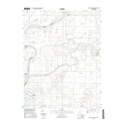
2016 Map of East Mount Carmel
USGS Topo · Published 2016About this map
The White River and Wabash River converge in a complex hydraulic landscape along the Illinois and Indiana border, defining the development of Mount Carmel and East Mount Carmel. This 2016 survey illustrates a region shaped by its watercourses, where the Patoka River meanders into the southern reaches and significant drainage projects like Thompson Ditch and Hull-Ditch manage the low-lying terrain. The map captures the agricultural and residential layout of Orrville, situated near the Orrville Hills and Orrville Cemetery. Local history is preserved in landmarks such as Scott Chapel Cemetery and Hanging Rock on the riverbanks. The environment remains characterized by extensive wetlands, including the Cypress Swamps and various oxbow features like Claypole Pond and Long Pond. These features, alongside Grand Rapids and Kellys Ripple, highlight the traditional importance of river navigation and management in this tri-county intersection of Wabash, Knox, and Gibson counties.
Find a feature on this map
57 named features on this map. Tap any name to fly to it.
Don’t see what you’re looking for? This feature index may not catch every label — zoom into the map to look around manually.
Map Details
Editions of this 2016 East Mount Carmel Map
This is the sole edition of this map. No revisions or reprints were ever made.
Other maps of this area

1901 · Princeton
USGS Topo · 1:62,500

1903 · Princeton
USGS Topo · 1:62,500

1903 · Patoka
USGS Topo · 1:125,000

1904 · Mount Carmel
USGS Topo · 1:62,500

1911 · Sumner
USGS Topo · 1:62,500

1913 · Sumner
USGS Topo · 1:62,500

1915 · Vincennes
USGS Topo · 1:62,500

1944 · Vincennes
USGS Topo · 1:62,500

1956 · Vincennes
USGS Topo · 1:250,000

1957 · Vincennes
USGS Topo · 1:250,000