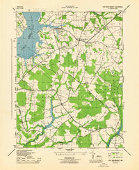
1944 Map of East New Market
USGS Topo · Published 1944About this map
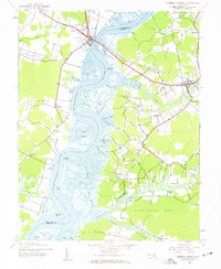
The Pennsylvania (Cambridge Branch) railroad cuts a diagonal path through this 1944 portrait of Dorchester County, Maryland, connecting agricultural hubs and small rural junctions during the mid-century era. At the center of the sheet, the town of East New Market serves as a local focal point, surrounded by essential community landmarks such as St Stephens Church, the East New Market Cemetery, and Mt Zion School. The landscape is defined by its proximity to the water, from the broad reaches of the Choptank River and Warwick River to the inland Higgins Millpond.
Find a feature on this map
51 named features on this map. Tap any name to fly to it.
Don’t see what you’re looking for? This feature index may not catch every label — zoom into the map to look around manually.
Map Details
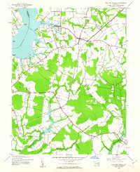
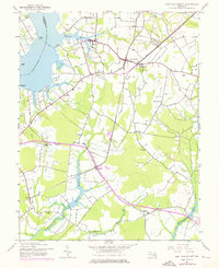
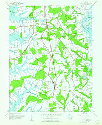
Editions of this 1944 East New Market Map
3 editions found
Other maps of this area

1898 · Choptank
USGS Topo · 1:125,000

1898 · St. Marys
USGS Topo · 1:125,000

1903 · Nanticoke
USGS Topo · 1:62,500

1904 · Oxford
USGS Topo · 1:62,500

1905 · Crapo
USGS Topo · 1:62,500

1905 · Hurlock
USGS Topo · 1:62,500

1906 · St. Marys
USGS Topo · 1:125,000

1908 · Choptank
USGS Topo · 1:125,000
1942 · Trappe
USGS Topo · 1:24,000
1942 · Mardela Springs
USGS Topo · 1:24,000