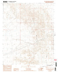
1985 Map of East of Broadwell Lake
USGS Topo · Published 1985About this map
The Bristol Mountains dominate this high-desert landscape in San Bernardino County, where industrial infrastructure cuts through a largely unpopulated terrain. Surveyed in the mid-1980s, the map reveals a pattern of mineral exploration defined by several scattered Prospect sites and Prospects in the northwestern quadrants, indicating a history of small-scale mining efforts. Running across the southern and central portions of the sheet are significant utility corridors, including a Trans Line and a long Pipeline that traverse the arid flats and lower slopes. These human-made lines contrast with natural drainage features such as the Wash that cuts through the southeastern corner, illustrating the intersection of modern utility expansion and the environmental reality of the Mojave desert.
Find a feature on this map
7 named features on this map. Tap any name to fly to it.
Don’t see what you’re looking for? This feature index may not catch every label — zoom into the map to look around manually.
Map Details
Editions of this 1985 East of Broadwell Lake Map
4 editions found
Other maps of this area

1942 · Amboy
USGS Topo · 1:250,000

1943 · Amboy
USGS Topo · 1:250,000

1953 · San Bernardino
USGS Topo · 1:250,000

1954 · Needles
USGS Topo · 1:250,000

1955 · Ludlow
USGS Topo · 1:24,000

1955 · Ash Hill
USGS Topo · 1:24,000

1955 · Broadwell Lake
USGS Topo · 1:62,500

1955 · Ludlow
USGS Topo · 1:62,500

1956 · San Bernardino
USGS Topo · 1:250,000

1956 · Needles
USGS Topo · 1:250,000