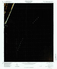
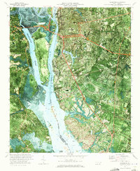
1980 Map of East Of Carolina Beach
USGS Topo · Published 1985About this map
Carolina Beach Inlet marks the interface between the coastal barrier and the open sea on this color infrared orthophotograph. Captured in the autumn of 1980, the imagery records the precise configuration of the shoreline and the scouring patterns of the inlet at that moment in time. The majority of the map is dedicated to the Atlantic Ocean, providing an unobstructed view of the nearshore waters and the submerged sandbars that define the North Carolina coast. This technical survey, produced through the simple projection of rectified photoimagery, serves as a specific reference for coastal change and maritime navigation just east of the mainland.
Find a feature on this map
2 named features on this map. Tap any name to fly to it.
Don’t see what you’re looking for? This feature index may not catch every label — zoom into the map to look around manually.
Map Details
Editions of this 1980 East Of Carolina Beach Map
This is the sole edition of this map. No revisions or reprints were ever made.
Other maps of this area

1942 · Wilmington
USGS Topo · 1:62,500

1946 · Snow Marsh
USGS Topo · 1:24,000

1948 · Wilmington
USGS Topo · 1:62,500

1953 · Beaufort
USGS Topo · 1:250,000

1954 · Beaufort
USGS Topo · 1:250,000
1970 · Kure Beach
USGS Topo · 1:24,000
1970 · Wrightsville Beach
USGS Topo · 1:24,000
1970 · Carolina Beach
USGS Topo · 1:24,000
1970 · Wilmington
USGS Topo · 1:24,000

1972 · Beaufort
USGS Topo · 1:250,000