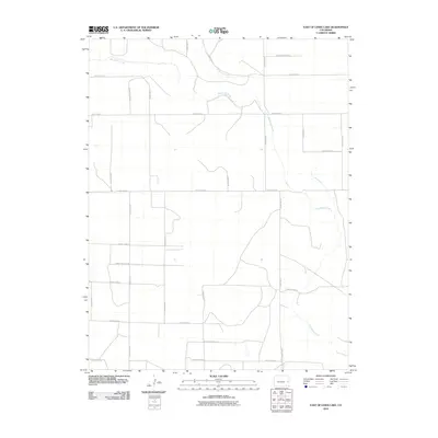
2010 Map of East of Lewis Lake
USGS Topo · Published 2010About this map
Big Sandy Creek winds through this expanse of eastern Cheyenne County, defining the drainage patterns of a landscape dominated by a rigorous section-line road grid. Mapping from this era illustrates a rural environment shaped by the intersection of natural watercourses and human engineering, where Big Spring Creek joins the larger creek system in the north. The survey details an extensive network of local thoroughfares, from County Rd K in the north to County Rd B at the southern edge, reflecting the enduring township-and-range layout of the High Plains. While largely open land, the map traces the precise routes of utility and transport corridors like County Rd 25 and County Rd 27 which serve the isolated farmsteads and agricultural plots characteristic of the region.
Find a feature on this map
21 named features on this map. Tap any name to fly to it.
Don’t see what you’re looking for? This feature index may not catch every label — zoom into the map to look around manually.
Map Details
Editions of this 2010 East of Lewis Lake Map
This is the sole edition of this map. No revisions or reprints were ever made.
Other maps of this area

1891 · Kit Carson
USGS Topo · 1:125,000

1893 · Kit Carson
USGS Topo · 1:125,000

1954 · Lamar
USGS Topo · 1:250,000

1958 · Lamar
USGS Topo · 1:250,000

1981 · Cheyenne Wells
USGS Topo · 1:100,000
1982 · Kit Carson 4 SE
USGS Topo · 1:24,000
1982 · Kit Carson
USGS Topo · 1:24,000

1982 · Kit Carson 4 NE
USGS Topo · 1:24,000

1982 · Kit Carson 4 NW
USGS Topo · 1:24,000
1982 · Firstview
USGS Topo · 1:24,000