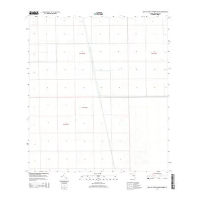
2015 Map of East of Little Cypress Swamp
USGS Topo · Published 2015About this map
The Miami Canal serves as the dominant hydrological and structural feature of this landscape in the Florida Everglades. This 2015 survey by the U.S. Geological Survey documents a region defined by precise section lines and water management corridors. The map area is primarily focused on the intersection of major township and range boundaries including T46s R35e, T46s R36e, T47n R35e, and T47s R35e. The layout of the canal system reflects the engineering required to manage the southern Florida interior, showing the stark, linear contrast between modern infrastructure and the surrounding wetlands.
Find a feature on this map
5 named features on this map. Tap any name to fly to it.
Don’t see what you’re looking for? This feature index may not catch every label — zoom into the map to look around manually.
Map Details
Editions of this 2015 East of Little Cypress Swamp Map
This is the sole edition of this map. No revisions or reprints were ever made.
Other maps of this area

1956 · West Palm Beach
USGS Topo · 1:250,000

1957 · West Palm Beach
USGS Topo · 1:250,000

1958 · West Palm Beach
USGS Topo · 1:250,000
1970 · Lake Harbor SE
USGS Topo · 1:24,000
1970 · Lake Harbor SW
USGS Topo · 1:24,000
1970 · Okeelanta
USGS Topo · 1:24,000
1974 · Everglades 1 SW
USGS Topo · 1:24,000
1974 · Everglades 2 SW
USGS Topo · 1:24,000
1974 · Everglades 2 SE
USGS Topo · 1:24,000
1974 · Everglades 1 NW
USGS Topo · 1:24,000