
1974 Map of Everglades 2 SW
USGS Topo · Published 1976About this map
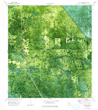
The Big Cypress Seminole Indian Reservation occupies the heart of this mid-1970s orthophotomap, revealing a landscape of wetlands and reclaimed swamp at the intersection of Hendry, Broward, and Collier counties. This unique perspective combines traditional topographic contour lines with aerial photography, highlighting the intricate network of water management features such as Levee 28 and the West Feeder Canal. Within the reservation, local history is rooted at the Browns Indian Trading Post (Ruins) and the Ahfachkee Day Sch, surrounded by the natural drainage of Godden Strand. The map records a period of transition where remote outposts like the Big Cypress Ch and New Testament Ch served a community shaped by the environment of the Canoe Lake Strand.
Find a feature on this map
23 named features on this map. Tap any name to fly to it.
Don’t see what you’re looking for? This feature index may not catch every label — zoom into the map to look around manually.
Map Details
Editions of this 1974 Everglades 2 SW Map
2 editions found
Other maps of this area

1956 · West Palm Beach
USGS Topo · 1:250,000

1957 · West Palm Beach
USGS Topo · 1:250,000

1958 · West Palm Beach
USGS Topo · 1:250,000

1973 · Everglades 3 NE
USGS Topo · 1:24,000

1974 · Immokalee 1 SE
USGS Topo · 1:24,000

1974 · Immokalee 1 NE
USGS Topo · 1:24,000

1974 · Everglades 2 SE
USGS Topo · 1:24,000
1974 · Everglades 2 NW
USGS Topo · 1:24,000
1974 · Immokalee 4 NE
USGS Topo · 1:24,000
1974 · Everglades 3 NW
USGS Topo · 1:24,000