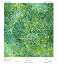
1974 Map of Immokalee 4 NE
USGS Topo · Published 1976About this map
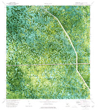
The Everglades Parkway (Toll Road) cuts a straight, horizontal line through this 1970s orthophotomap, representing a major infrastructure intervention in the Collier County interior. This composite image reveals the complex hydrology of the Big Cypress region, where the Kissimmee Dark Strand and Jones Strand form dense, dark corridors of vegetation amidst a mosaic of cypress domes and wet prairies. Small-scale human activity is visible at the isolated Fruit Fly Camp and several remote landing strips, reflecting the area's history of agricultural monitoring and backcountry access.
Find a feature on this map
16 named features on this map. Tap any name to fly to it.
Don’t see what you’re looking for? This feature index may not catch every label — zoom into the map to look around manually.
Map Details
Editions of this 1974 Immokalee 4 NE Map
2 editions found
Other maps of this area

1956 · West Palm Beach
USGS Topo · 1:250,000

1957 · West Palm Beach
USGS Topo · 1:250,000

1958 · West Palm Beach
USGS Topo · 1:250,000

1974 · Everglades 2 SW
USGS Topo · 1:24,000

1974 · Immokalee 4 NW
USGS Topo · 1:24,000

1974 · Immokalee 1 SW
USGS Topo · 1:24,000

1974 · Immokalee 1 SE
USGS Topo · 1:24,000
1974 · Immokalee 4 SW
USGS Topo · 1:24,000
1974 · Everglades 3 SW
USGS Topo · 1:24,000
1974 · Everglades 3 NW
USGS Topo · 1:24,000